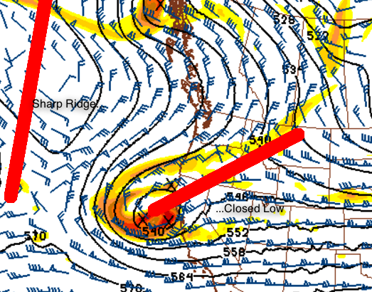
Beginning around/ after the 24th of February… It looks like the dominant weather feature over the west coast should be an upper-level ridge of high pressure. This would mean completely dry weather for California and south through Arizona, possibly lasting through the first week to 10 days of March, before we see Pacific storms return to the west coast. We do still need to be watchful for “closed low” pressure systems, since a sharp ridge can tend to allow these to form as we move into spring. These can easily cause rain in the deserts. I will add more detail to this as needed.